Christchurch to Queenstown: Which Route and Where to Stop
The direct drive from Christchurch to Queenstown is about 482 km and takes just under six hours non-stop, inland via Lake Tekapo, Twizel and the Lindis Pass (Enterprise NZ). With fuel, food and photo stops a realistic day runs 8 to 10 hours. Two days with a night at Tekapo or Twizel suits most people, and four days lets you add Aoraki/Mount Cook and Wānaka without rushing.
This is the most-driven leg in the South Island and the spine of most routes in our South Island itinerary guide. Pick your route by how many days you have, not by which blog shouts loudest.
Which route should you take from Christchurch to Queenstown?
Two routes run inland and fit in a day. Two go the long way round and need at least three days.
| Route | Distance | Non-stop driving | Who it suits |
|---|---|---|---|
| Inland via Tekapo and Cromwell | about 482 km | just under 6 hours | One long day, or two days with a night in the Mackenzie |
| Inland via Wānaka and the Crown Range | about 495 km | about 7 hours | Two to four days in a car or small campervan, outside winter |
| West Coast via Arthur's Pass and Haast Pass | about 745 to 790 km | about 10.5 to 12 hours | Three to five days for glaciers and rainforest |
| Coastal via Dunedin | about 640 km | about 8 hours | Three days or more for Oamaru, Moeraki and Dunedin |
Inland via Tekapo and Cromwell is the fastest. You take State Highways 1 and 79 to Lake Tekapo, 226 km and just under three hours from Christchurch (Enterprise NZ). State Highway 8 then carries you through Twizel and over the Lindis Pass, and State Highway 6 finishes through the Kawarau Gorge.
Inland via Wānaka and the Crown Range is the most scenic for the time. It leaves the fast route at Tarras, runs to Wānaka, then climbs the Crown Range Road. Wānaka to Queenstown is 68.5 km over the Crown Range or 111 km via Cromwell (Enterprise NZ). The full route is about 495 km and at least 7 hours behind the wheel (Destinationless Travel).
West Coast via Arthur's Pass and Haast Pass crosses the Southern Alps twice. Apollo's version through Hokitika, Franz Josef and Haast totals 743 km and about 10 hours of driving (Apollo). Tourism New Zealand's version via Greymouth and Fox Glacier comes to 767 km (newzealand.com). Check Haast Pass on NZTA Journeys before you commit.
Coastal via Dunedin is about 640 km and about 8 hours non-stop. Pick it for penguins, the Moeraki Boulders and a night in Dunedin. The first half is covered in our Christchurch to Dunedin road trip .
Where should you stop on the inland route?
Here are the stops in order from Christchurch. The times are how long to stop, not how long to drive.
- Rakaia Gorge (20 to 30 minutes). This means taking the Inland Scenic Route instead of State Highway 1. The gorge is about 87 km and an hour from Christchurch (Destinationless Travel), and the route rejoins the main road at Geraldine (Wikipedia). It's slower but far better than the flat run through Ashburton. Skip it on a one-day push.
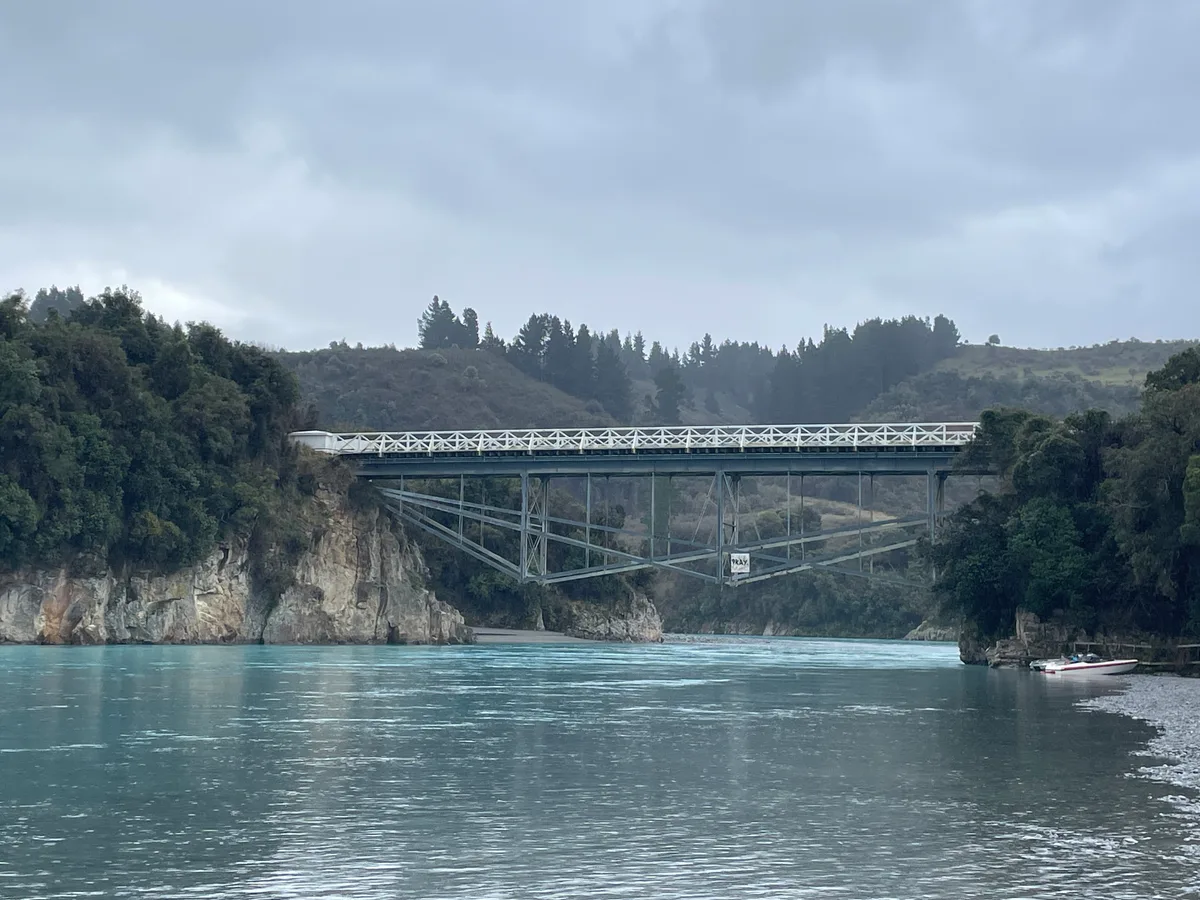
Rakaia Gorge on the Inland Scenic Route. Photo: Mrastron, CC BY 4.0. - Geraldine (30 to 60 minutes). About 140 km from Christchurch (The Trusted Traveller) and the natural coffee stop. It's the last town of any size before the hills.
- Fairlie (20 to 40 minutes). Come for the pies. The Fairlie Bakehouse hand-fills every one and opens 6am to 4.30pm daily, closed only on 25 and 26 December. After Fairlie the road climbs over Burkes Pass into the Mackenzie Basin.
- Lake Tekapo (45 to 90 minutes). The Church of the Good Shepherd gets crowded through the middle of the day, so go early or at sunset. Tekapo sits inside the Aoraki Mackenzie International Dark Sky Reserve, which is the best reason to stay the night. In late spring, read our guide to lupin season at Tekapo first.
- Lake Pukaki lookout (20 to 40 minutes). The visitor centre on State Highway 8 is about 10 km north of Twizel, and its salmon shop opens 9am to 5pm daily, weather permitting (Mt Cook Alpine Salmon). On a clear day you look straight up the lake to Aoraki/Mount Cook.
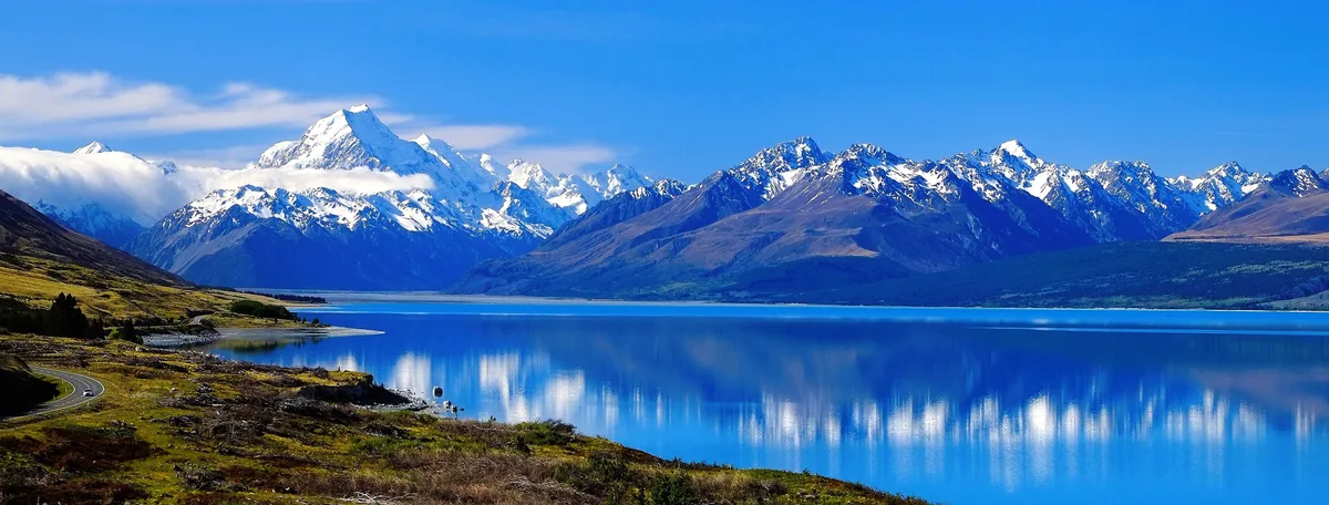
Aoraki/Mount Cook over Lake Pukaki from Peters Lookout. Photo: Francis Vallance (Heritage Warrior), CC BY 2.0. - Twizel (30 to 60 minutes). Fuel, groceries and coffee, and a practical base if Tekapo is full. Sort food and fuel here before the Lindis. Kiwi Guide shows places to eat and fuel near where you are, so check it in town while you have signal rather than up on the pass.
- Ōmarama Clay Cliffs (60 to 90 minutes with the detour). Sharp gravel pinnacles on private land, reached by an unsealed road off Quailburn Road, with a NZ$5 per car honesty box, so bring cash (Tourism Waitaki). Check your rental agreement allows unsealed roads. Ōmarama is about 30 km past Twizel (We Are Craving Adventure).
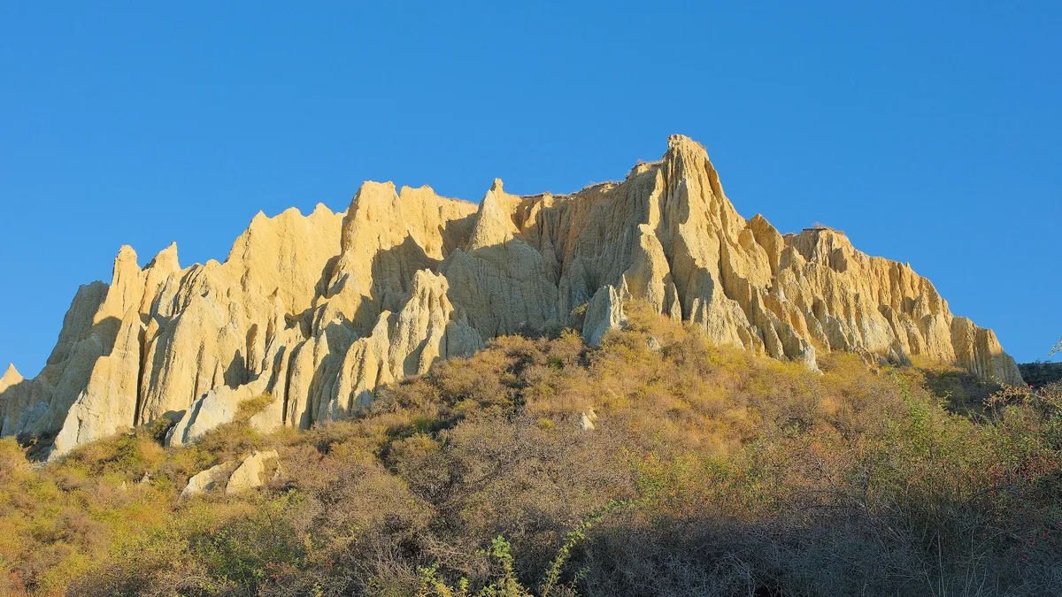
The Clay Cliffs near Ōmarama in early morning light. Photo: Pseudopanax, public domain. - Lindis Pass (15 to 25 minutes). At 971 metres this is the high point of State Highway 8 (newzealand.com). The summit lookout is about 32 km past Ōmarama, then it's about 45 km of tussock valley down to Tarras (We Are Craving Adventure).
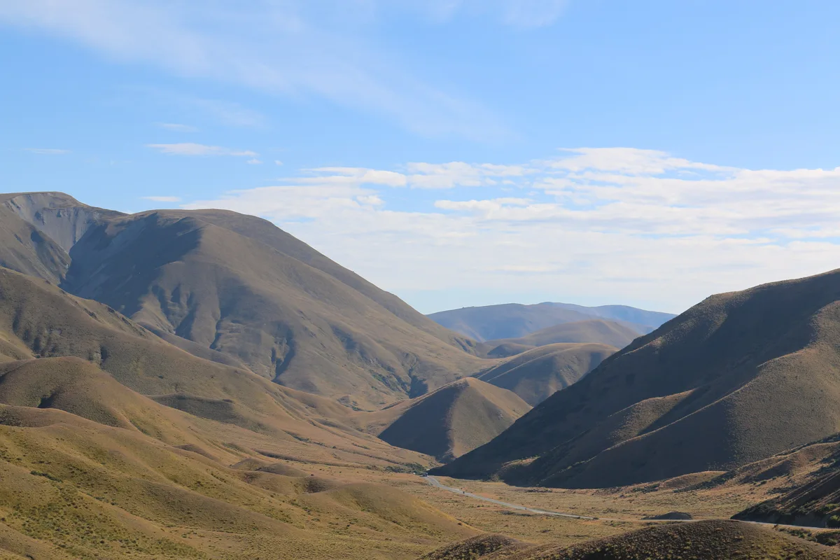
Tussock country at the Lindis Pass summit. Photo: Wildman NZ, CC BY-SA 4.0. - Cromwell (45 to 90 minutes). Walk the Heritage Precinct on the edge of Lake Dunstan and buy fruit from the stalls in summer. Queenstown is about 58 km and 45 minutes on (NZ Spirit).
- Kawarau Gorge and Gibbston (20 minutes to half a day). The Kawarau Gorge Suspension Bridge sits 43 metres above the river and was the world's first commercial bungy site (Wikipedia). Stop and watch a few jumpers. Gibbston is Pinot Noir country, so save tastings for a tour day or a sober driver.
Which detours are worth a night?
Aoraki/Mount Cook Village and the Hooker Valley Track
State Highway 80 runs about 55 km from the Pukaki turn-off to the village and you come back the same way. That adds about 110 km and roughly 1.5 hours of driving (NZ Spirit).
The Hooker Valley Track is easy and takes about 3 hours return from White Horse Hill car park, over three swing bridges. The second bridge is new and opened in July 2026. Parking there costs NZ$2.50 per half hour or NZ$25 a day, no cash, with the first 20 minutes free. DOC warns that snow can close State Highway 80.
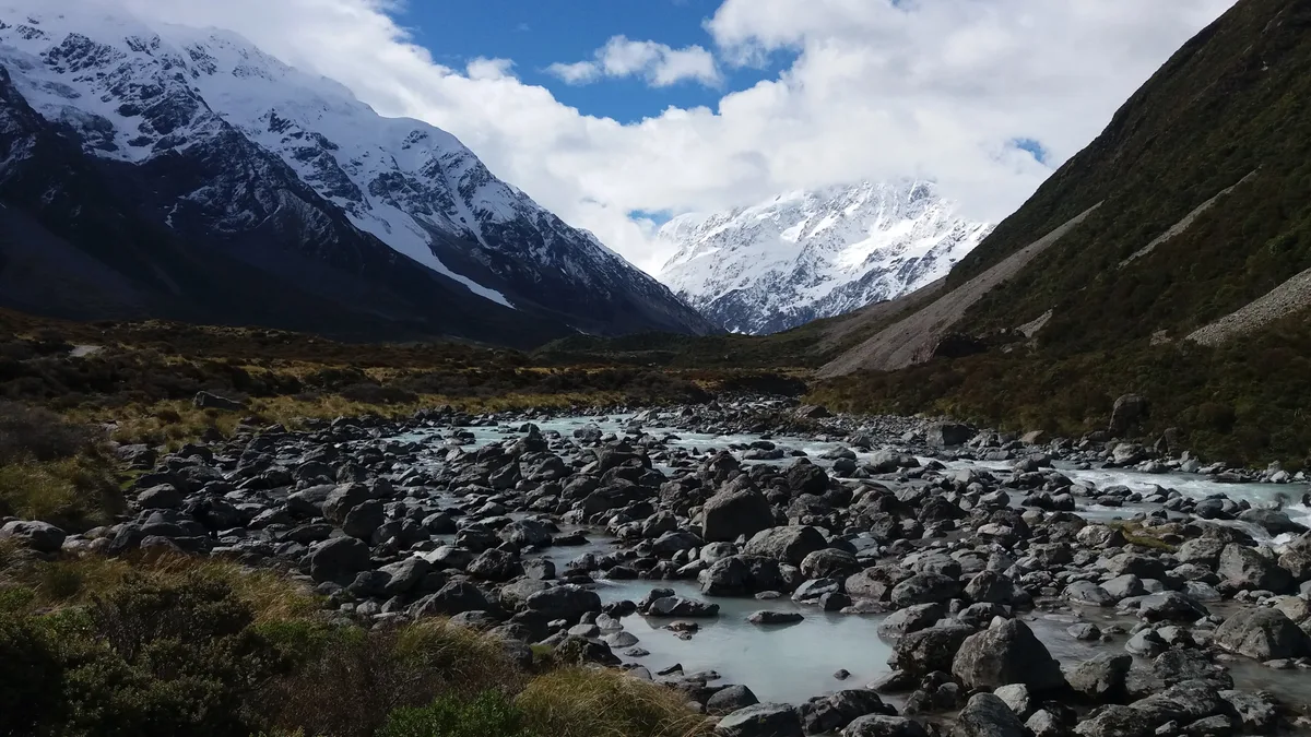
Our verdict: if the mountain is clear, stay a night in the village or Twizel and walk early. If it's socked in, keep driving. Shops in the village are limited, so stock up in Tekapo or Twizel.
Wānaka
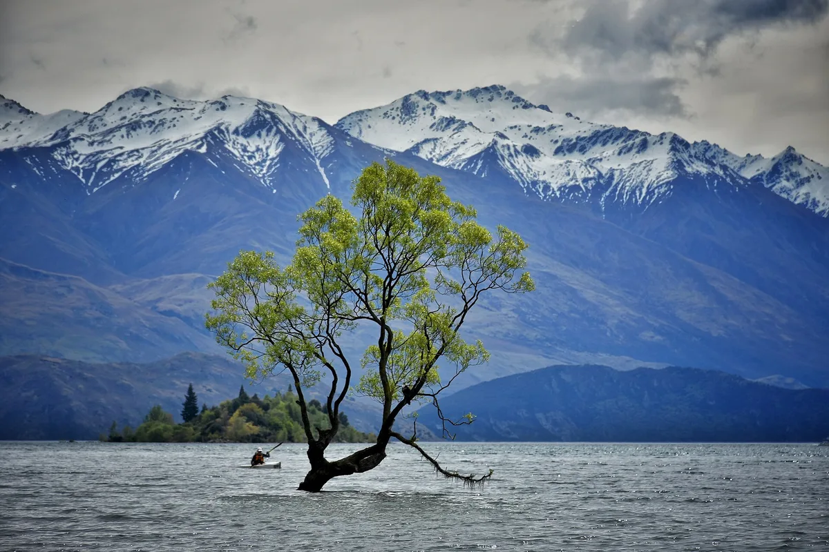
At Tarras turn off for Wānaka, about 35 km and 30 minutes away (We Are Craving Adventure). It's a calmer lake town than Queenstown, with an easy lakefront walk for the evening. From there you finish over the Crown Range or round via Cromwell.
How many days do you need? Three sample plans
One day: 8 to 10 hours
Leave Christchurch by 7am. Coffee in Geraldine, a pie in Fairlie, an hour at Tekapo, the Pukaki lookout, fuel in Twizel, the Lindis lookout and a break in Cromwell. You reach Queenstown by late afternoon after about 6 hours of driving.
Overnight: Queenstown. It works, but you'll see most of the Mackenzie through the windscreen.
Two days: a night in the Mackenzie
Day 1: Christchurch to Tekapo via Rakaia Gorge, Geraldine and Fairlie, about 3 to 3.5 hours of driving. Spend the afternoon at the lake. Overnight: Tekapo, or Twizel if Tekapo is full.
Day 2: Tekapo to Queenstown via Pukaki, Twizel, the Clay Cliffs and the Lindis, about 255 km and 3 to 3.5 hours of driving. Overnight: Queenstown.
Four days: add Mt Cook and Wānaka
Day 1: Christchurch to Tekapo, 226 km and about 3 hours. Overnight: Tekapo.
Day 2: Tekapo to Mt Cook Village, 104 km and about 1 hour 15 (Enterprise NZ). Walk the Hooker Valley in the afternoon. Overnight: Mt Cook Village or Twizel.
Day 3: Mt Cook Village to Wānaka, 206 km and about 2.5 hours over the Lindis, plus the Clay Cliffs detour if you want it (Skyline). Overnight: Wānaka.
Day 4: Wānaka to Queenstown over the Crown Range (about 1 hour 10) or via Cromwell (about 1 hour 30). Overnight: Queenstown. If Milford Sound is next, read Queenstown to Milford Sound before you book.
Daylight and pass conditions change all three plans. Our guide to the best time to visit the South Island covers that month by month.
Can you get from Christchurch to Queenstown without a car?
Yes. InterCity runs a daily coach that takes about 8 hours 10 minutes. It leaves from outside the Bus Exchange on Lichfield Street and arrives at the Athol Street car park in central Queenstown, stopping at towns including Geraldine, Tekapo, Ōmarama and Cromwell. It doesn't go into Mt Cook Village (NZ Spirit).
The coach leaves Christchurch in the morning, so check the departure time in the InterCity booking search. Heading north, the direct service leaves Queenstown at 8.05am and reaches Christchurch at 4.45pm (InterCity). Either way you'll need a night in town before a morning departure.
Air New Zealand is the only airline flying the route nonstop, usually several times a day, and the flight takes about an hour. Fly if time matters more than scenery. Take the coach if you want to see the Mackenzie without driving it.
Driving notes: Lindis Pass, fuel and which way to go
For rental rules, winter tyres and the basics, start with our guide to driving in the South Island . These notes are specific to this route.
Lindis Pass in winter
Snow can sit on the Lindis for months, often down to the roadside (newzealand.com), and ice is a risk from May to September (The Central App). Snow closed State Highway 8 between Ōmarama and Tarras on the morning of 19 August 2025 (NZTA Journeys). It closed again on 27 October 2025, so spring isn't safe either (The Central App).
In heavy snow NZTA has made chains compulsory on the pass and closed it to towing vehicles. It tells drivers to check they have chains and know how to fit them (NZTA via Scoop). Between June and September ask your rental company for chains, check NZTA Journeys that morning and cross in the middle of the day.
Where fuel gets scarce
Geraldine, Tekapo and Twizel all have reliable stations (NZ Spirit). The gap is the pass. From Ōmarama it's about 77 km over the Lindis to Tarras with no towns between (We Are Craving Adventure), then about 25 minutes more to Cromwell (Trip Ideas). Ōmarama has a Challenge station open 6am to 9pm with a card terminal after hours. Tarras has had a small self-service pump, but don't count on it. Fill up in Twizel or Ōmarama and don't start the pass under half a tank. Fill before the Mt Cook side trip too, since it's 110 km return. Fuel is usually cheaper in Christchurch than in the Mackenzie (NZ Spirit).
The Crown Range in a campervan
The Crown Range Road tops out at 1,076 metres, the highest sealed through road in New Zealand (Wikipedia). The Queenstown side climbs a steep zig-zag of tight bends, and it's often covered in snow and ice in winter (The Central App). Queenstown Lakes District Council calls it one of the district's most high-risk alpine routes. You must carry chains and fit them when conditions call for it, and from winter 2026 not fitting them can cost NZ$750 (QLDC). The council can also close the road's gates in severe weather.
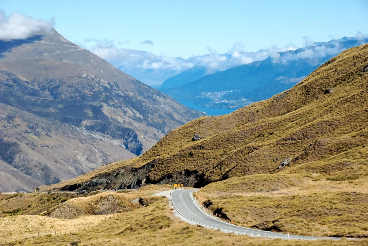
Apollo bans its campervans from the road, citing steep and narrow conditions (Apollo). Our verdict: in a car or small van in summer, take it slowly and enjoy it. In a big campervan, in winter or if your rental agreement says no, go via Cromwell.
Which direction to drive
Go whichever way your flights and one-way rental fees work out. Heading north, Aoraki/Mount Cook comes into view up the lake as you reach Pukaki. Heading south, you get the flat Canterbury stretch over with early while you're fresh and finish through the Kawarau Gorge.
Frequently asked questions
How long is the drive from Christchurch to Queenstown?
The direct inland route via Lake Tekapo and the Lindis Pass is about 482 km and takes just under six hours without stops. Most people take 8 to 10 hours once fuel, food and photo stops are added. The West Coast route is about 750 to 790 km.
Can you drive from Christchurch to Queenstown in one day?
Yes, if you leave by about 7am and keep stops short. Expect 8 to 10 hours door to door. Avoid doing it the day you land from a long-haul flight, and in winter check the Lindis Pass on NZTA Journeys first.
Is it worth stopping at Mt Cook on the way to Queenstown?
Yes, if the weather is clear and you have a spare half day. The detour from Lake Pukaki adds about 110 km and 1.5 hours of driving, plus about 3 hours for the Hooker Valley Track. If the mountain is hidden in cloud, skip it.
Is the Crown Range Road safe in a campervan?
A small campervan can manage it with care in good summer weather, but the zig-zag bends are steep and tight. Some rental companies, including Apollo, ban their campervans from it. In winter chains are required when conditions call for them, so big vans are better off on State Highway 6 via Cromwell.
Do you need snow chains for the Lindis Pass?
Carry them from June to September, and in spring or autumn if snow is forecast. NZTA makes chains compulsory on the pass in heavy snow and has closed it to towing vehicles. Check NZTA Journeys the morning you drive.
Is there a bus from Christchurch to Queenstown?
Yes. InterCity runs a daily coach that takes about 8 hours 10 minutes, stopping at towns including Geraldine, Tekapo and Cromwell. It leaves from Lichfield Street in the morning, so check the current timetable on intercity.co.nz.
Find your next pie stop between Christchurch and Queenstown
Kiwi Guide shows places to eat, fuel and things to do near where you are, from Geraldine to Gibbston. It leans towards cheap and cheerful, which on this road usually means a good pie.
Explore Kiwi Guide